Monochromatic Geographic Information System Map Clipart with Color-Coded Markers

A detailed clipart representation of a geographic map interface featuring a stylized outline of a region with various colored markers indicating specific locations, accompanied by a comprehensive legend and navigation tools
1535x87948.86KBimage/webp

Stylized Navigation Map Clipart with Location Pointer and Route Markers

Winding Navigation Road Journey with Location Markers Clipart Illustration

Urban Navigation Map Clipart with Location Pins and Street Network Design

Vintage Paper Map Clipart with Navigation Compass and Location Marker

Digital Camera Control Panel Interface with Navigation Buttons and LCD Screen
Digital Navigation Smartphone Clipart with GPS Location Tracking Illustration
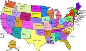
Colorful United States Map Clipart – A Vivid Representation of American Geography

Folded Paper Map with Bright Red Location Marker Clipart Illustration

Vintage Treasure Map Clipart with Red X Marking Mysterious Island Location

Minimalist Location Pin Marker on Stylized Map Clipart Graphic Design

Simplified Geometric Location Marker Clipart with Folded Map Design

United States Map Location Marker Clipart Illustration Design

Vintage Treasure Map Clipart with Stylized Navigation Elements and Landmarks

Colorful Folded Map Navigation Clipart with Bright Red Pinpoint Marker

Exploring Geographic Navigation: Magnifying Glass Revealing Map Clipart Treasure

Educational Classroom Scene with Teacher and Students Learning Geography Clipart

Colorful Educational World Globe Clipart Illustration for Learning Geography

Engaging Elementary Student Learning Geography with Colorful Earth Clipart Illustration
Minimalist Dual Smartphone Clipart Rendering with Neutral Gray Interface